© Joe Douglas. 2016
Force Crag Mine
This was the mine we visited most often and it is, now owned by the National Trust. It is two and a half miles along a track that leaves Whinlatter Pass just above Braithwaite. The track goes the whole length of the Coledale valley to the mine which is in two parts above and below Force Crag.
All the mineral processing was done at the lower site and the ore brought down via an overhead cable way. In the 1950’s the pylons were still standing but no sign of any cable.
I remember it not so much for its minerals but because of where it located and the great times we had on day trips and the weeks we camped there in the Summer Holidays for a couple of years.

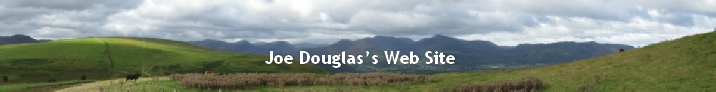
We camped on a small level grassy patch just below the junction of the two streams you can see in the picture. The stream you can see in the picture tumbled noisily down the crag was quickly referred to as Pi**y Willie.
There were three of us camped there and we cycled the five miles to Keswick for supplies and all the fun of the fair.
The location was very remote and the only people passing were walkers who walked up a steep path to the top of the crag and into Coledale Hause. They were usually passing at weekends and in mid-
One night it was quite warm so two of us dragged our sleeping bags outside the tent to sleep.
I was wakened next morning by a raucous rendition of ‘”Flowers that Bloom in the Spring Tra-
I managed to interrupt his performance and point at the path rising up past the crag on the other side of the valley. (Left hand side of the picture. It was marked by a line of girl guides in their blue uniforms heading for Coledale Hause and beyond. They were early risers as they were already two and a half miles from Whinlatter Pass. I have never seem him move so fast, before or since, as he completed his last lap and dived into the tent.
I really enjoyed telling his grandchildren of their granddads activities in his youth but he has got his own back several time since.
The photographs show the screes at the right hand side of the crag. These were natural screes supplemented by some mining debris. The scree material was quite small and running down them was great fun and gave us a quick way down from the top mine.
Unfortunately someone decided to cut a track across the scree. We only discovered this when we found ourselves rapidly approaching an edge with no idea what was over it. We couldn’t stop and went off the edge, managed to clear the track and still be upright when we ‘touched down’ on the scree and carried on to the bottom.
Our interest in fossils was extended to include Minerals and the Lake District is a very rich hunting ground for mineral collectors. Having survived the cycle rides to and from the quarries the next step was to go into the fells to find the old, some very old, mines. Our reference was the schools fifty years old copy of Mines and Mining in the Lake District by John Postlethwaite. First published in 1889 it was a comprehensive collection of old mineral workings all over the Lake District.
For more details of the few mines mentioned and others please follow this link to the Interesting Links page.
The Pumbago Mine
It is about twenty miles to the Plumbago mine near Seathwaite at the head of Borrowdale and getting there was a major excursion for a pair of second formers on very simple, heavy bikes. The mine was the source of graphite, (wad), which ultimately led to the start of the Cumberland Pencil Company in Keswick. The Company is still going strong but is now located on a large industrial estate on Winscales moor near Workington.
Back in the early 50’s the various levels of the mine were marked by the tips at each one marching up the fell side. the mine with its many levels was clearly seen 'stepping' up the fell side. Today the site is much harder to see from the valley floor unless you know where to look.
OLD MINES
Carrock Mine
Our first visit to Carrock turned out to be quite an arduous adventure. With more miles than we had done before over some very unpleasant ground.
We started with catching the five past eight bus to Keswick and walking round the base of Latrigg and going north up the narrow Glenderaterra valley and picking up the river Caldew flowing roughly north east. The mine is located just up Grainsgill beck near where the river Caldew swings east to run alongside Carrock Fell.
The fun started on the way back to Keswick. We decided to keep to the east of the Caldew on the way back to Keswick. The walk started across firm ground but soon changed to huge swathes of thick, spongy Sphagnum Moss rippled out from our footsteps as we trudged over it.It then crossed Sinen Gill and Roughton Gill, both quite deep with deep sides. It was very tiring and there was still several mile to go to Keswick bus station. The spelling ‘Gill’ is from Sheet 82 -
After that experience we always came back looping up the western flank of Blencathra to avoid the moss and avoid the descent/ascent of the gills.
We made many trips to that area, mostly using the first bus to Keswick, 5 past 8 from the Main Street, then the Penrith bus to Mungrisdale Road End. From there we walked to the village and into the valley behind Between Blencathra and Carrock fell. Because of the volcanic history of the Skiddaw and Carrock the whole area was very rich in minerals and had been mined quite extensively in the past. This was, and I suppose still is, a popular hunting ground for mineral collectors. Using the trusty Postlethwaite book we located quite a few mines scattered in the area.
On one visit, at the height of the Myxomatosis outbreak two of us were sat on the side of Carrock Fell in a small area clear of bracken having out sandwiches.
There was a rustling in the bracken opposite us and a fox appeared. It stood and watched us for a few minutes before sitting down and continued its watch. It stayed there watching until we had finished, picked up our rucksacks and set off. Before we had left the clearing it had moved to where we had been and was looking for scraps we might have left behind.
The consequence of removing the rabbits from the food chain was very clear as that fox overcame its fear of us.
The back of Skiddaw seemed to be a favourite place for groups of soldiers, led by a junior officer to exercise. On several occasions, all when visibility was poor to almost non-
Loweswater Lead Mine
The first old mine we visited was a lead mine near Loweswater. The workings we went too were probably the last trial mine in the area on the west side of Mosedale under Hen Comb. It was basically a large hole in the fell side with tunnels into the fell looking for the lead vein. Only one was accessible for about 30 yards. Traces of galena, the lead ore, and other common minerals could be seem in the tunnel wall. The mine was within easy cycling distance so we made several visits. When we went there we left our bikes behind a wall and walked into the fells for the day.
I was in the mine with a friend one day when he suddenly said he was going home as his mother had just died. We ran down the fell to our bikes and sprinted back to Cockermouth. It took about three quarters of an hour. When he got home his mother had died three quarters of an hour earlier.